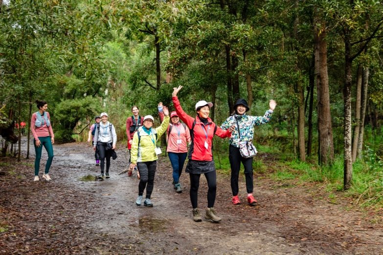
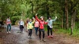
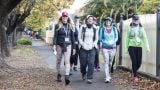
The historic trail
The Pioneer Women’s Trail honours the early Europeans who settled in Hahndorf, and supplied Adelaide with fresh produce at a time when most foodstuffs had to be imported into South Australia. Within weeks of their arrival in 189 the women and girls were walking the rough bush track to Adelaide, 35km away. They left the village at midnight, carrying baskets of vegetables and dairy products on their backs or on yokes across their shoulders.
After walking about 26km the women reached a stream in the foothills near Beaumont, where they rested and tidied themselves before continuing into Adelaide to hawk their wares. Their load on the homeward journey might include sewing thread and needles, sugar, tea, some tobacco for the menfolk and two bricks each for building a church in Hahndorf.
They continued to carry supplies to Adelaide in this way until the late 1850s.
The modern trail
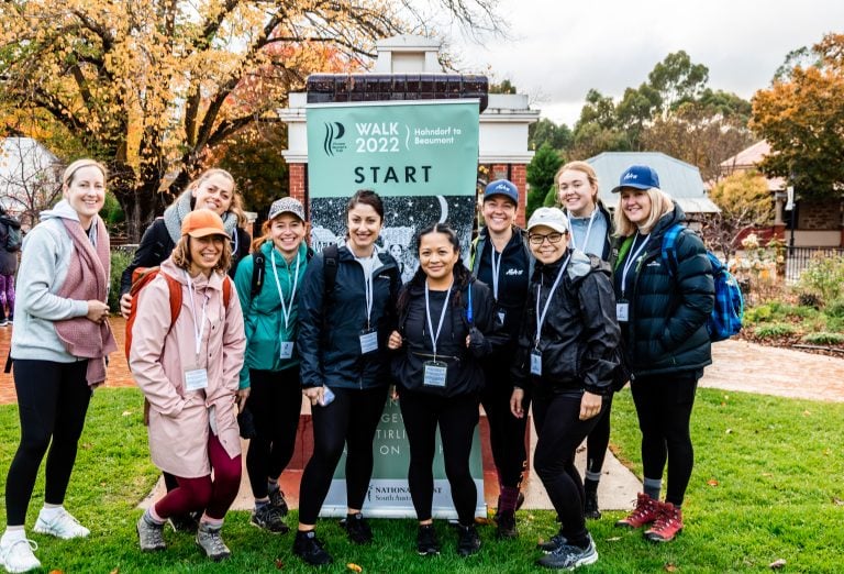
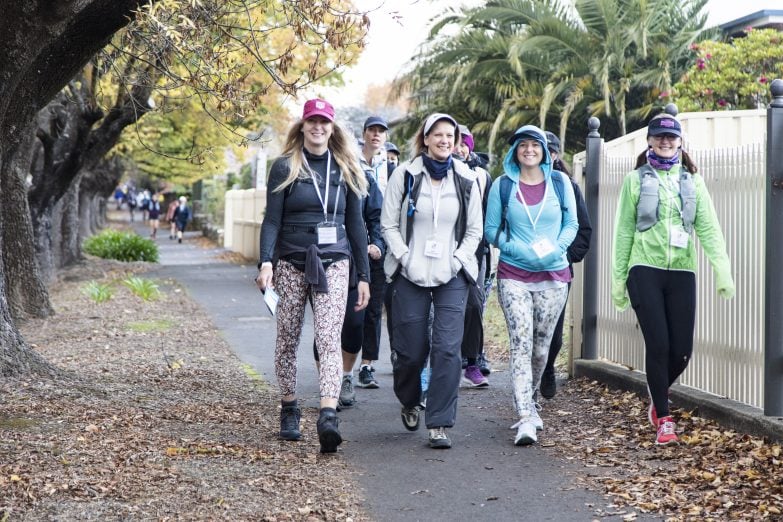
In 1979 six members of the Hahndorf Branch of the National Trust of South Australia, followed as closely as possible the trail shown on a map produced on 18 June 1841 by surveyor FR Nixon. The following year, 1980, the first public walk along its full length took place. There were a number of walks in the 1980s and 1990s, but the trail was not properly marked and officially launched until 2007. The first walk as a South Australian History Festival event took place in 2010.
Originally the women utilised Peramangk walking trails along the ridgetops, and the bullock tracks that had been established very early after white settlement. It is not possible to follow this route exactly because of private property that now covers much of the traditional trail, and the South East Freeway which cuts through the middle. The modern trail therefore deviates where necessary to go round these obstacles, and to take advantage of as much bush and parkland as possible.
Trail notes
Hahndorf
The Adelaide Hills are the traditional lands of the Peramangk people.
On 28 December 1838, when the British colony of South Australia was barely two years old, the 344 tonne ship Zebra carrying 187 German Lutheran immigrants (38 families) arrived in Port Adelaide. The ship’s passengers were unfortunately unable to disembark the ship until 2 January 1839 due to low tide. The ship’s captain, Dirk Meinertz Hahn, had grown to respect the passengers and offered to help them find a place to settle. He was able to negotiate with the Adelaide entrepeneurs William Hampden Dutton, Captain John Finnis and Duncan MacFarlane for a parcel of land in the Adelaide Hills.
The negotiated contract provided the families with 100 acres of land rent free for the first year, and in return the men of the village were required to provide labour to the businessmen in nearby Mount Barker. Of this 19 acres were allocated for housing and roads and the remainder for cultivation. In addition the settlers were also provided with a years’ provision of seeds and some livestock, all on credit as a communal debt. The settlers resolved to buy the land at the end of the first year; however, it took them a few years to completely discharge the debt. In addition to the 38 families that arrived on the “Zebra” an extra 14 families who had previously settled at Klemzig joined the settlement. Some new arrivals from the ship “Catherina” also settled there. The new settlement was named in honour of Captain Hahn.
In 1839 the village layout was designed as a U-shaped Hufendorf of small farmsteads with the Lutheran Church (St Michaels) as the focus. The base of the U shape design ran along Main Street and the limbs on North Lane (now Victoria Street) and South Lane (English Street). Each family was provided with a parcel of land which was large enough for a house, garden and small farm. However 10 years later as the town’s population rapidly grew and additional land was purchased, a plan was needed to extend the town. The additional land was subdivided into 100 foot allotments on Main street and gave Hahndorf the appearance of a Strassendorf (street village). The combination of these two distinct village plans contributes to the unique characteristics of Hahndorf today.
Verdun
The freeway now obscures the route the women walkers took from Verdun, up the Mount Stanley spur and down into Bridgewater. In 1839 on his way to his property at Bull Creek, Mr Bull’s brakes did not hold on this hill and his horses bolted down the spur to the ford and he mentions that he had great difficulty in dodging the stumps left by the woodcutters. The bullock drivers had to find easy slopes where they could climb the hills and return with a load. The bullock tracks were not always followed by the women, who found that in some areas the narrow Peramangk tracks along the ridgetops were more suitable for walkers.
Cox (or sometimes, Cox’s) Creek, the Deanery and Bridgewater
The Pioneer Women’s Trail follows Cox Creek from Avoca Avenue to Old Carey Gully Road, with some small detours along the way.
A party of four men set out from Adelaide on Christmas Day 1837 in an attempt to reach the River Murray. Their leader was Robert Cock. (He and a fellow Scotchman, William Ferguson, were Adelaide’s first stock and station agents). Cock undertook the trip with an eye to business. Another Scot, Pastor William Finlayson, went with him because he had come to the Colony with the idea of being a missionary among the natives. He returned from this trip disappointed because he did not meet a single Aboriginal. He was the official reporter and published an account of the trip in the Register on his return and gave further details later in his reminiscences. The other two men were Valentine Wyatt and George Barton, who went purely in a spirit of adventure.
Finlayson states that they measured two stringybark trees near Crafers that went 36’ and 40’ 6” in circumference. He goes on to say:
When we got to Crafers, we found some splitters of stringybark rails at their Christmas dinner. We continued our journey, steering by compass, as there were no more stations of white men. … We had not gone many miles, when our horse got bogged in crossing what has ever since been named Cock’s Creek, after our leader, but our united strength could not pull him out, and we were obliged to return to Crafers for help, when Mr Wilson and his stepsons willingly returned with us, and then by great exertions and main force, we got him out and camped for the night. …
They did not reach the River, but turned south and became the first white men to reach Lake Alexandrina overland from Adelaide.
The name Cock’s Creek soon became corrupted to Cox Creek, then Cox’s Creek.
It is not generally known that there was a flour mill worked by a waterwheel on Cox Creek as far back as 1842. It was situated behind sheep paddocks just above the spot where Cox Creek joins the Onkaparinga near River Road, Hahndorf. It did not last long, as it was wrecked by a flood. The owner, Mr Wittwer, built a new steam mill in Hahndorf and moved the grindstone from Cox Creek. These same stones that ground wheat in 1842 now stand in front of St Michael’s Lutheran Church in Hahndorf.
Bridgewater
During the 1840s, the Government built a new road to the Mt Barker district. This followed the route of the present bitumen main road in the Bridgewater area. Traffic naturally used the better road and an earlier village at Cox Creek eventually found itself left high and dry on a back track.
This was bad for business (some business, anyway) but it was not long before the hotel moved to its present site on the new road. In 1855 the licence of the hotel at Bridgewater was taken over by James Addison, who named it the Bridgewater Hotel. There are very few older hotels outside the suburban area. Addison had previously been the licensee of the Deanery Hotel, which had lost its clientele when the route to Adelaide was moved and became the Mount Barker Road. By that time the need for the women to carry their goods on their backs to Adelaide had lessened, but continued for a while.
Bridgewater was considered a good site for a flour mill. From Woodside in the East round to Meadows in the South was a wheat growing area then, and much of the wheat had to be carted through Bridgewater to Adelaide, so the mills there were well-situated to buy wheat. They were close to the market and one mill at least had a cheap source of power in the waterwheel.
In 1860, John Dunn & Co began a new industry when they built the Bridgewater Mill. The Lion Mill at Carripook (corner of Kain Road and Mount Barker Road), generally called the Old Mill, began work in 1855, and Dunn leased this for three years until his new Bridgewater Mill was ready. The Lion Mill was sold to a man named Trilling in the early ‘70s and he removed the machinery to a mill he had built at Jamestown. For some years after that, the empty mill and the hotel were celebrated for miles around for the jolly dances held there.
The Bridgewater Mill has a waterwheel which weighs 26 tons when full of water, is 37’ in diameter and develops 20 hp. One authority says that the wheel uses 6,500 gallons of water per minute.
For many years, John Dunn gave an annual picnic for all his employees at the Bridgewater Mill. A bullock would be roasted whole on a spit which was kept turning by the water wheel.
A railway from Adelaide to Aldgate was opened for traffic on 14 March 1882. Construction of the next section, Aldgate to Nairne, had already commenced in October 1880. The contractors, Bailey, Davis and Wishart, leased the Lion Mill from Martin Kain for 7/- per week and used it as a depot.
A camp for navvies who built the railway sprang up in Bridgewater and its peace and quiet was disturbed for a while. It became necessary to establish a police station on the recreation ground, the first police station between Adelaide and Mount Barker. Sittings of the local court were often held in the house of the Justice of the Peace, Colonel Barber.
The Mount Barker Courier for this period contains many reports of cases tried there. The usual charge was ‘drunk and disorderly’.
The Deanery (just past the corner of Arbury Park Road and Old Mount Barker Road)
In the early years of settlement produce from the Mt Barker district had to reach Adelaide by bullock drays as the terrain was too steep and rough for horses. These drays made tracks through the bush wherever it was convenient, and that track had to find a place to ford Cox’s Creek. The spot chosen was a few yards upstream from where the Deanery Bridge stands today.
A little settlement on Cox Creek had grown sufficiently to make it worthwhile for Benjamin Dean and his wife, Elizabeth, to set up a Wayside pub in March 1841, which he somewhat ironically called The Rural Deanery. It is still possible to find the hole excavated for the cellar under the Hotel Bar. The spot is about 20 yards upstream from the bridge and on the northern bank. There was no accommodation there, but travellers stopped for ale or porter, and the bullock teams were rested.
A gang of cattle rustlers was associated with the Deanery, and Hahndorf’s women walkers are believed to have been the victims of extortion on one occasion. They may have spotted bullocks being spirited away to a hidden gully for slaughter while their drunken drivers were sleeping off their night’s pleasures. They may have even recognised the culprits.
The dam just above the railway embankment did not store enough water for the waterwheel at Bridgewater Mill, so in 1870 another was built further upstream on the property now called Arbury Park. Almost as soon as it was finished, it was destroyed by a flood which carried away the Deanery Bridge, the lower dam and the Main Road Bridge. The upper dam was never rebuilt.
The new Deanery Bridge was washed away again in April 1887, and the third bridge was made longer with a centre pillar added.
The mill dam was a popular picnic spot. Bathing parties were common and there were boats on the water. It was the scene of a tragedy in the very month the mill started work. The newspapers report that a boy was drowned ‘through going for a sail in a packing case’.
Mount George Conservation Park
This park was traditionally the land of the Peramangk Peoples. During the 1840s much of the surrounding area was cleared by European settlers for farming and market gardens. Today, due to the conservation efforts of the local community and the region’s cool winter conditions, Mount George Conservation Park features a great variety of vegetation and spring flowers.
Crafers and the Tiersmen
The area we know as Crafers was the first to supply Adelaide with timber. The colony lacked labourers who were proficient at working with native timbers, so the British officials were soon in need of ex-convicts from Van Diemen’s Land who had acquired highly prized woodworking skills.
The hills were then called the Tiers, because of their appearance when seen from the plain, and these ‘Vandemonians’, who lived rough in the Old Stringybark Forest, became known as Tiersmen. Tiersmen also included runaway sailors and escaped convicts from other colonies, some of whom became cattle-rustlers and bushrangers as a sideline to their timber work. The track between Crafers and Bridgewater was the most feared area for the Hahndorf women, even though the police force was increased in 1838 due to the rioting and thieving behaviour of the Tiersmen.
David Crafer and his wife, Mary Ann, started a hotel in Crafers in March 1839, and the district eventually took its name from him. This hotel was the first one licensed outside of what is now known as Adelaide and the suburbs. The Crafers Inn provided good food and accommodation for travellers, but was also a haunt of the Tiersmen when they were thirsty from their exhausting work as timber-fellers. They were also lonely for the charms of women, so a gang of cattle rustlers opened a brothel near Crafers. There were stories of encounters between the Hahndorf women and suspicious characters who were implored not to take advantage of ‘poor and defenceless women’. While the women tried to avoid harassment by carrying heavy sticks, they could scarcely evade the colourful clientele of the pub at Crafers.
Cleland Conservation Park
Cleland Conservation Park has been a protective haven for native flora and fauna since 1963, but the impacts of a long history of timber felling and agriculture are still evident in the Park. Many large forest trees were logged from the 1830s, leaving a network of trails used to haul timber down to the city. Farming activities included sheep and cattle grazing, which resulted in significant erosion, and many of the lower slopes were cleared for market gardens, vineyards and olive groves.
In 1963, the land transferred to the National Parks Commission. It became Cleland Conservation Park in the 1970s, when the land surrounding Waterfall Gully and Mt Lofty Summit were added to the reserve. Part of the area had been protected in1945, when the South Australian Government purchased the land at public auction, thanks to 20 years of lobbying by the eminent pathologist and naturalist, Sir John Burton Cleland (1878-1971).
The Kaurna Aboriginal people of the Adelaide Plains know the area as Yurridla. Their Dreaming stories tell of Yurrebilla, the creator ancestor of the Kaurna people. His fallen body forms the Mt Lofty Ranges, with his ears being the twin peaks of Mt Lofty and Mt Bonython. Today, the spirit of Yurrebilla looks down from the hills and protects all forms of life along the plains.
Eagle on the Hill Hotel
The hotel is situated on the road just above Gate 14, where the Cleland Park trail joins the Bullock Track. It was built in 1850 and owned as an eating house by William Oliver. Its principal patrons were the first toilers of the hills – the bullock drivers. It was first licensed in 1852.
In 1853 the licensee was William Anderson, who named it the Anderson Hotel. The hotel was later called the Eagle on the Hill, as the licensee kept a caged eagle for many years.
The hotel has twice been ravaged by bushfires. First in 1899; a fire destroyed all of the old hotel with the exception of two rooms. Again on Ash Wednesday (16 February 1983) the hotel suffered, with it being completely destroyed. The statue of the eagle was saved from the fire, and was placed on a plinth when the hotel was rebuilt. It operated with much success until its closure after the construction of the new freeway route diverted traffic away from the hotel. The eagle can still be seen in front of the building.
Eagle on the Hill to Beaumont
The final section of the track to the top of Gleeson’s Hill is still called the Bullock Track, and is the only section that has retained its historic name and route. Gleeson’s Hill is one of many spurs which travellers to and from the Hills took, and was a steep and difficult ascent and descent. The modern trail zigzags down instead of taking the direct but precipitous route.
A man named Miller kept a sly grog shanty on the top of Gleeson’s Hill, which proved very handy to travellers to the Tiers, after slaving up the fearful hills. Mr Crafer was very much annoyed with these shanties, and did all he could to stop them, but was outwitted by the quick-thinking Miller when a policeman tried to trap him.
At the foot of Gleeson’s Hill is Brock Reserve. The Brock family is notable for its connections with the early inland explorations of Captain Charles Sturt and for its promotion of the olive.
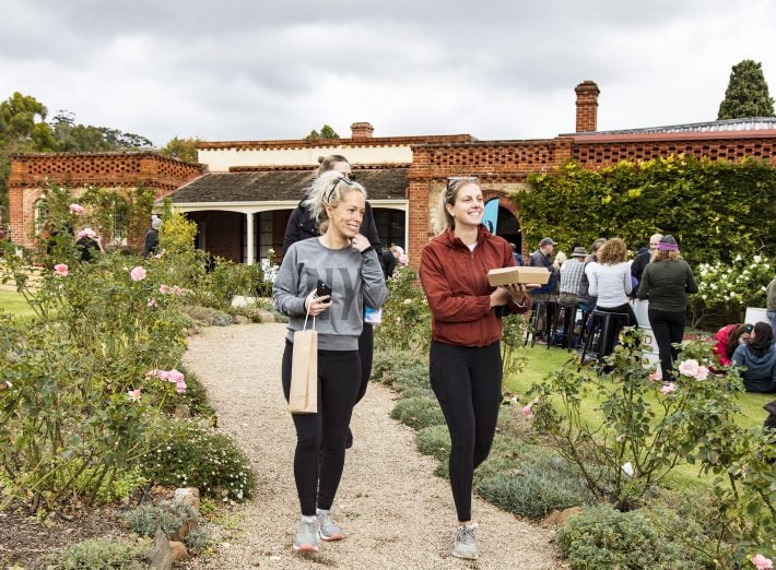
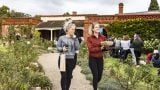
Beaumont House: https://www.nationaltrust.org.au/sa/
Beaumont House, built in 1849, was home of the first Anglican Bishop of Adelaide, Bishop Augustus Short, and later of Sir Samuel Davenport, politician, horticulturist and founder of the olive oil industry in South Australia. Davenport was the second of five eventual owners. Following three sales between 1907 and 1911, the house was transferred to the National Trust of South Australia in 1968 and has been listed on the South Australian Heritage Register since 24 July 1980.
Davenport planted a small number of olives around Beaumont House in 1852 after he purchased the land the previous year. Davenport later expanded his groves by replanting trees and cuttings from Beaumont both in other areas of the allotment and at some of his other properties in the Adelaide Hills.
Originally a five-bedroom residence, the Beaumont House estate was expanded considerably by successive owners.
It now accommodates the head office of the National Trust of South Australia. There are many events at the property, and the house is open on these occasions. Weddings also take place in the beautiful gardens.
Sources:
Anni Luur Fox: Early Hahndorf and the Pioneer Women’s Trail.
Anni Luur Fox: Hahndorf; a Journey Through the Village and its History.
GS Fowler: Bridgewater on Cox Creek, Adelaide Hills Localwiki.
Thomas Hardeman: My Early Colonial Life, Adelaide Hills Localwiki.
http://www.australiannationalparks.com/southaustralia/Cleland/default.htm, http://www.slsa.sa.gov.au/manning/pn/e/e1.htm